
Secure Your Next Land Acquisition
Integrate spatial GIS validation, risk scoring, and historical title reconstruction into your legal pipeline. De-risk multi-crore land acquisitions with India's premier land trust infrastructure.
Request a Land Audit
Provide your parcel details below. Our spatial verification experts and legal analysts will coordinate directly with your team to initiate the six-step land hashing process.
Frequently Asked Questions
Review our protocols for spatial verification, historical title chain reconstruction, and secure document vaulting to understand how we protect your investments.
How long does it take?
How is data secured?
A standard six-step verification—from title document validation to GIS boundary mapping—is typically completed within five to seven business days.
All verified documents are stored in our encrypted Vault, and a unique digital registry hash is issued to prevent future title tampering.
What documents are required?
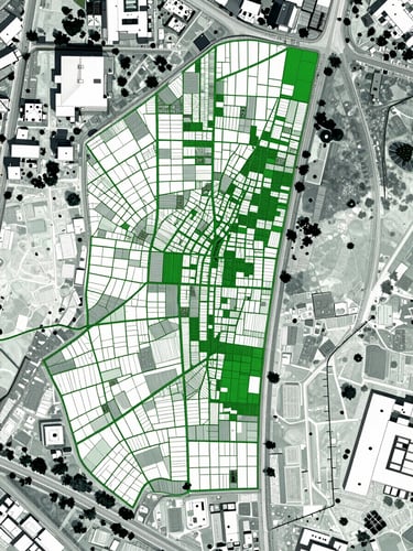
Do you map boundaries?
Yes, our GIS boundary validation cross-references historical maps with modern satellite data to pinpoint overlaps and discrepancies before you acquire.
We require basic ownership deeds, parent documents dating back thirty years, and any existing survey maps or spatial records to begin the audit.
Get in touch
Share with visitors how they can contact you and encourage them to ask any questions they may have.

